
Length: 5.2 miles (shuttle)/10.4 miles (out and back)
Estimated Time: 2 to 4 hours
Difficulty: Moderate
Location: Butner-Falls of Neuse Game Land
Trail Users: Hiking only
Dogs: Must be on a leash
Features: Lakes, Creeks, Forest,
Crowds: High
Warnings: Part of the trail passes through game land where hunting is permitted. Wear blaze orange during hunting season. Crossing Laurel Creek can be difficult if the water is up.
Trailhead GPS: 36.01240,-78.68914 (Creedmoor Road/NC-50) / 35.99104,-78.71965 (Boyce Mill Road)
Directions:
Section 11 trailhead is along Creedmoor Road/NC-50 just before the bridge over Falls Lake. From I-540 in North Raleigh take exit 9 for Creedmoor Road. Go north on NC-50 for 6.7 miles and pull over on the wide pull-off on the left, just before the bridge.
To arrange a shuttle, turn around and go south on NC-50 for 1.6 miles and turn right to get on NC-98 west towards Durham. Go 2 miles and turn right on Boyce Mill Road, which becomes gravel. Follow 0.6 miles to a parking area just before the closed gate.
Map:
In the following map, the hike is shown in pink.

Click here for an interactive map of the entire Falls Lake Trail.
Hike Description:
The trail picks up at a kiosk towards the lake. Section 10 heads eastbound across the road; see Section 9 and 10 Hike for more description. It initially follows a cove and turns right at a powerline clearing in 0.4 miles. Go a short ways through the clearing and go right to head back into the woods.

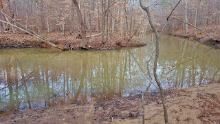
The trail follows the shoreline closely, crossing a couple small tributaries. The second has a nice new footbridge.

At 1.2 miles, the trail crosses into Durham County and there are nice views of Rolling View Marina at about 1.7 miles.

The trail then enters another cove and begins following an unnamed tributary upstream. There are some nice cascades on this tributary.

At 2.8 miles, the trail intersects the Old Creemoor Trail network and again at 3.6 miles. At around 4 miles, the trail passes by an old farmstead with several old buildings still standing.


After this, the trail crosses several more small tributaries before reaching Laurel Creek. In normal water levels, it's fairly easy to rock hop, but in high water, the crossing can be difficult.

The trail follows an old roadbed that is prone to flooding. There is an old barn off the trail to the left.

After the barn, the trail turns and gradually ascends, ending at Boyce Mill Road at 5.2 miles. The trail continues down the gravel road; see Section 12 Hike for more details. If you shuttled, the shuttle will be here; it not, turn around.
External Links:
Mountains-to-Sea Trail website: https://mountainstoseatrail.org/the-trail/segments/falls-lake-day-hikes/fallslake-dayhike-10/
No comments:
Post a Comment