Thursday, we woke up before 5, packed up and checked out of the hotel. We stopped at a 24-hour gas station to grab breakfast and then headed north to the trailhead for North Mount Elbert Trail. Mount Elbert would be our first 14er; in fact our first mountain higher than Mount Mitchell. The Rocky Mountains are notorious for afternoon storms in the summer, so we wanted to start early and arrived at the trailhead just after 6. A spur trail lead to the Colorado Trail (#1776), where we turned left towards Mount Elbert. The first part of the trail was only moderately steep as it headed up through a forest. In a little over a mile, the trail split and we went right on North Mount Elbert Trail (#1484). The trail got a little steeper, but still not too bad and it was still forested. In about 2.5 miles, we reached 12,000 feet and got above the tree line. At this point, the trail got significantly steeper, but we had great views. It wasn't a great view of Mount Elbert, but we had clear views of Mount Massive.

The headwaters of Elbert Creek had snow in it.

The best views were around 12,800 feet where we had a clear view of Mount Elbert and snow near the summit.

Snow in July! It was also clear just how much further we had to go up. As we got closer to the summit, it got really steep but there were still some hardy wildflowers blooming amidst the loose rocks.

Hairy goldenaster have bright yellow flowers.

Soon, we made it to the top, getting there just before 10.

Quite a few people were up here as well as dogs. The view looking east was really hazy from the wildfire smoke, but it was clear views in all other directions.

We spent some time up here enjoying the panoramic views from Colorado's highest point.
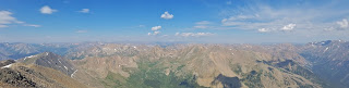
It was really beautiful here from the high point of the Rocky Mountains.

We had a light lunch before heading back down. The first part of the descent was tricky as it was so steep down loose rocks and gravel. Stopping to view the wildflowers provided a couple much-needed breaks. Sticky polemonuim had really pretty little blue flowers.

Moss campion is an arctic species that can grow at very high elevations this far south.

Shrubby cinquefoil was probably the most common wildflower way above the treeline.

Eventually, the slope decreased and it was downhill, so the going was fast. Soon, we were below the tree line and made it back to the car a little after noon.

Our next destination was Colorado Springs, so we drove back to Buena Vista and took US-24 east. We passed the road that was closed due to the fire. A little over half-way to Colorado Springs, we made a detour to Florissant Fossil Beds National Monument. In the visitor center, they had some nice displays of fossils that had been discovered in the park.

No dinosaurs or large animals, but lots of plants and insects.

The insect fossils were surprisingly recognizable - orb-weaver spiders, wasps, beetles and other bug fossils in stone.

Outside the visitor center, were some of the petrified stumps protected from the elements under shelters.

These massive petrified tree stumps were from redwoods that grew in Colorado millions of years ago when the climate was warmer. The Trio were three huge stumps right next to each other.

Next, we hiked the Petrified Forest Trail towards the Big Stump. A few patches of bright red Indian paintbrush were blooming in the dry terrain.

We also saw some penstemon flowering.

Soon, the trail led to the Big Stump. This was a truly massive redwood tree that had left a petrified stump so large.

Just past the stump we could see the Hornbek Homestead in the distance.
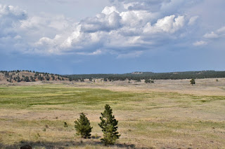
Continuing on the trail, we spotted some white thistle flowering.

A few more petrified stumps were along the trail but none as large and impressive as the big one.

We finished up the loop at the visitor center and headed back to the car. From here, we drove back towards the highway and made a quick stop to check out the Hornbek Homestead.

The homestead is a replica of a typical Colorado ranch from the late 1800s.

It is named for Adeline Hornbek, a pioneer woman who raised four children here.

As we were walking around, the weather was getting worse and a storm was rolling in, so made for great pictures.

But rains were coming so we didn't linger long.

Driving away, we spotted a mule deer along the road.

On the way to Colorado Springs, a hail storm rolled in and the temperature plummeted. At one point, we had to pull over as visibility dropped to zero. After the storm passed, we stopped in Manitou Springs for dinner at the Loop and then continued to the Hilton Garden Inn to check in for the evening. After a very long day, the hot tub was very relaxing.

The headwaters of Elbert Creek had snow in it.

The best views were around 12,800 feet where we had a clear view of Mount Elbert and snow near the summit.

Snow in July! It was also clear just how much further we had to go up. As we got closer to the summit, it got really steep but there were still some hardy wildflowers blooming amidst the loose rocks.

Hairy goldenaster have bright yellow flowers.

Soon, we made it to the top, getting there just before 10.

Quite a few people were up here as well as dogs. The view looking east was really hazy from the wildfire smoke, but it was clear views in all other directions.

We spent some time up here enjoying the panoramic views from Colorado's highest point.

It was really beautiful here from the high point of the Rocky Mountains.

We had a light lunch before heading back down. The first part of the descent was tricky as it was so steep down loose rocks and gravel. Stopping to view the wildflowers provided a couple much-needed breaks. Sticky polemonuim had really pretty little blue flowers.

Moss campion is an arctic species that can grow at very high elevations this far south.

Shrubby cinquefoil was probably the most common wildflower way above the treeline.

Eventually, the slope decreased and it was downhill, so the going was fast. Soon, we were below the tree line and made it back to the car a little after noon.

Our next destination was Colorado Springs, so we drove back to Buena Vista and took US-24 east. We passed the road that was closed due to the fire. A little over half-way to Colorado Springs, we made a detour to Florissant Fossil Beds National Monument. In the visitor center, they had some nice displays of fossils that had been discovered in the park.

No dinosaurs or large animals, but lots of plants and insects.

The insect fossils were surprisingly recognizable - orb-weaver spiders, wasps, beetles and other bug fossils in stone.

Outside the visitor center, were some of the petrified stumps protected from the elements under shelters.

These massive petrified tree stumps were from redwoods that grew in Colorado millions of years ago when the climate was warmer. The Trio were three huge stumps right next to each other.

Next, we hiked the Petrified Forest Trail towards the Big Stump. A few patches of bright red Indian paintbrush were blooming in the dry terrain.

We also saw some penstemon flowering.

Soon, the trail led to the Big Stump. This was a truly massive redwood tree that had left a petrified stump so large.

Just past the stump we could see the Hornbek Homestead in the distance.

Continuing on the trail, we spotted some white thistle flowering.

A few more petrified stumps were along the trail but none as large and impressive as the big one.

We finished up the loop at the visitor center and headed back to the car. From here, we drove back towards the highway and made a quick stop to check out the Hornbek Homestead.

The homestead is a replica of a typical Colorado ranch from the late 1800s.

It is named for Adeline Hornbek, a pioneer woman who raised four children here.

As we were walking around, the weather was getting worse and a storm was rolling in, so made for great pictures.

But rains were coming so we didn't linger long.
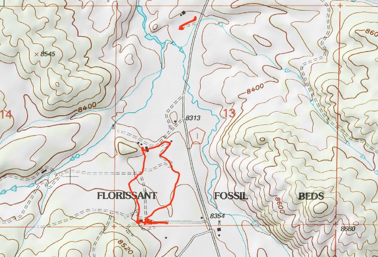
Driving away, we spotted a mule deer along the road.

On the way to Colorado Springs, a hail storm rolled in and the temperature plummeted. At one point, we had to pull over as visibility dropped to zero. After the storm passed, we stopped in Manitou Springs for dinner at the Loop and then continued to the Hilton Garden Inn to check in for the evening. After a very long day, the hot tub was very relaxing.


