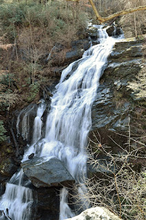
Melrose Falls is a 60-foot waterfall on Big Falls Creek, a tributary of North Pacolet River, in Polk County, North Carolina. The waterfall is on land owned by Pacolet Area Conservancy and open to the public.
Hike Length: 1.0 mile
Estimated Time: 1 hour
Difficulty: Moderate
Location: Pacolet Area Conservancy
Trail Users: Hiking only
Dogs: Must be leashed
Features: Waterfalls (1)
Crowds: Moderate
Warnings: The rocks around waterfalls are very slippery. Use caution on the boulders at the viewpoint as a fall here would be fatal.
Trailhead GPS: 35.22192,-82.30707
Waterfall GPS: 35.22050,-82.29873
Directions:
From Saluda, take exit 59 on I-26. Head south on Ozone Road for just under a mile and turn left on US-176 E. Follow US-176 for 3.3 miles to a pull-off at old road on the right. The pull-off is in between two bridges over North Pacolet River. There is room for a few more cars to park on the other side of the road.
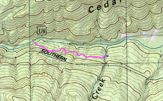
Map:
Hike Description:
Hike up the old road to head towards the waterfall. There are two forks in the trail - at the first bear left and at the second bear right. In about half a mile, you'll reach the waterfall. A steep path leads down to a rock outcrop near the middle of the falls with decent views.


No comments:
Post a Comment